
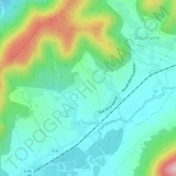
Les Poulières topographic map
Interactive map
Click on the map to display elevation.
About this map
Name: Les Poulières topographic map, elevation, terrain.
Average elevation: 1,673 ft
Minimum elevation: 1,437 ft
Maximum elevation: 2,326 ft
The commune is positioned between Épinal to the west and Saint-Dié to the north-east, in the valley of the Neuné, a tributary of the Vologne River. Neighbouring communes are Biffontaine and La Chapelle-devant-Bruyères. Les Poulières is at the confluence of several roads, but roads here are small and twisting, thanks to the topography, on the western fringes of the Vosges Mountains.