
Blaen-y-coed topographic map
Interactive map
Click on the map to display elevation.
About this map
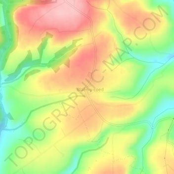
Name: Blaen-y-coed topographic map, elevation, terrain.
Location: Blaen-y-coed, Carmarthenshire, Wales, SA33 6ET, United Kingdom (51.91605 -4.40527 51.91960 -4.40090)
Average elevation: 568 ft
Minimum elevation: 308 ft
Maximum elevation: 801 ft