
Bückeberg topographic map
Interactive map
Click on the map to display elevation.
About this map
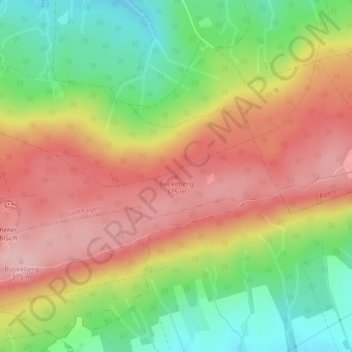
Name: Bückeberg topographic map, elevation, terrain.
Average elevation: 932 ft
Minimum elevation: 620 ft
Maximum elevation: 1,214 ft
Other topographic maps
Click on a map to view its topography, its elevation and its terrain.
Habichhorst
Deutschland > Niedersachsen > Landkreis Schaumburg > Stadthagen
Habichhorst, Stadthagen, Landkreis Schaumburg, Niedersachsen, 31655, Deutschland
Average elevation: 318 ft
Wendthagen
Deutschland > Niedersachsen > Landkreis Schaumburg > Stadthagen
Wendthagen, Stadthagen, Landkreis Schaumburg, Niedersachsen, 31655, Deutschland
Average elevation: 528 ft