Geolocate

Spring topographic map

Click on the map to display elevation.

About this map

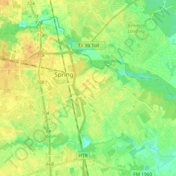
Name: Spring topographic map, elevation, terrain.

Location: Spring, Harris County, Texas, 77373, United States (30.02628 -95.43658 30.11562 -95.30924)

Average elevation: 112 ft

Minimum elevation: 69 ft

Maximum elevation: 148 ft

Harris County trails, hiking, mountain biking, running and outdoor activities

Gear up for your next adventure:

🥘Titanium Cookware - Durable, featherlight pots and pans for backpacking
🚪Portable Camp Chair - Foldable chair for comfort at camp
🌧️Backpack Rain Cover - Keep gear dry in wet weather
🧭GPS Watch Accessories - Bands and chargers for GPS watches
🔋Solar Power Banks - Keep your GPS and phone charged in remote wilderness areas

As an Amazon Associate, this site earns from qualifying purchases at no extra cost to you.