
Sorana topographic map
Interactive map
Click on the map to display elevation.
About this map
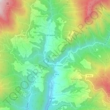
Name: Sorana topographic map, elevation, terrain.
Location: Sorana, Pescia, Pistoia, Toskana, 51017, Italien (43.94269 10.68874 43.98269 10.72874)
Average elevation: 1,519 ft
Minimum elevation: 561 ft
Maximum elevation: 3,166 ft