
Río Cidacos topographic map
Interactive map
Click on the map to display elevation.
About this map
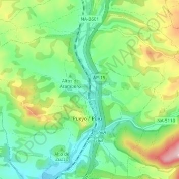
Name: Río Cidacos topographic map, elevation, terrain.
Location: Río Cidacos, Pueyo, Navarra, 31300, España (42.54870 -1.66509 42.59858 -1.64151)
Average elevation: 1,709 ft
Minimum elevation: 1,434 ft
Maximum elevation: 2,260 ft
Other topographic maps
Click on a map to view its topography, its elevation and its terrain.