
Ban Khok topographic map
Interactive map
Click on the map to display elevation.
About this map
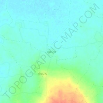
Name: Ban Khok topographic map, elevation, terrain.
Location: Ban Khok, Si Sa Ket Province, Thailand (14.73560 104.59765 14.77560 104.63765)
Average elevation: 482 ft
Minimum elevation: 443 ft
Maximum elevation: 600 ft