
la Isla topographic map
Interactive map
Click on the map to display elevation.
About this map
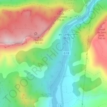
Name: la Isla topographic map, elevation, terrain.
Location: la Isla, Camarasa, Noguera, Lérida, Cataluña, 25613, España (41.88225 0.86623 41.90225 0.88623)
Average elevation: 1,562 ft
Minimum elevation: 820 ft
Maximum elevation: 2,677 ft