
Refuge de Colomers topographic map
Interactive map
Click on the map to display elevation.
About this map
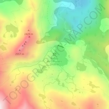
Name: Refuge de Colomers topographic map, elevation, terrain.
Average elevation: 7,336 ft
Minimum elevation: 6,109 ft
Maximum elevation: 8,750 ft
Other topographic maps
Click on a map to view its topography, its elevation and its terrain.
Refuge de la Restanque
Espagne > Catalogne > Lérida > Naut Aran
Refuge de la Restanque, Camin dera Restanca, Naut Aran, Val-d'Aran, Lérida, Catalogne, 25539, Espagne
Average elevation: 7,090 ft