
Puerto Nariño topographic map
Interactive map
Click on the map to display elevation.
About this map
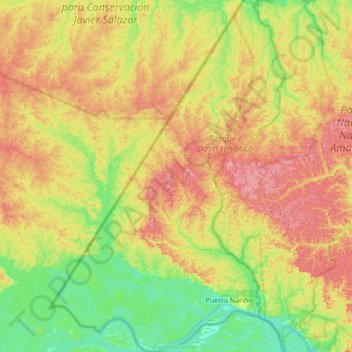
Name: Puerto Nariño topographic map, elevation, terrain.
Location: Puerto Nariño, Amazonas, RAP Amazonía, Colombie (-3.88092 -70.71330 -3.19730 -70.30266)
Average elevation: 331 ft
Minimum elevation: 197 ft
Maximum elevation: 522 ft
Other topographic maps
Click on a map to view its topography, its elevation and its terrain.
La Victoria (Pacoa)
Colombie > Amazonas > La Victoria (Pacoa)
La Victoria (Pacoa), La Victoria, Amazonas, Colombie
Average elevation: 518 ft
Caserío Salto Del Tequendama
Colombie > Amazonas > Caserío Salto Del Tequendama
Caserío Salto Del Tequendama, Mirití-Paraná, Amazonas, Colombie
Average elevation: 367 ft