
双元水库 topographic map
Interactive map
Click on the map to display elevation.
About this map
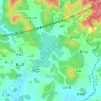
Name: 双元水库 topographic map, elevation, terrain.
Location: 双元水库, 天湾, 双元村, 下镇镇, 玉山县, 上饶市, 江西省, 中国 (28.66432 118.40630 28.67452 118.41697)
Average elevation: 495 ft
Minimum elevation: 381 ft
Maximum elevation: 751 ft