
Boubroune topographic map
Interactive map
Click on the map to display elevation.
About this map
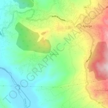
Name: Boubroune topographic map, elevation, terrain.
Location: Boubroune, Azazga, Daïra Azazga, Tizi Ouzou, 15300, Algérie (36.71431 4.33634 36.75431 4.37634)
Average elevation: 1,007 ft
Minimum elevation: 440 ft
Maximum elevation: 1,926 ft
Other topographic maps
Click on a map to view its topography, its elevation and its terrain.
Aït Bouada
Algérie > Tizi Ouzou > Daïra Azazga > Azazga
Aït Bouada, Azazga, Daïra Azazga, Tizi Ouzou, Algérie
Average elevation: 1,542 ft
Hendou
Algérie > Tizi Ouzou > Daïra Azazga > Azazga
Hendou, Azazga, Daïra Azazga, Tizi Ouzou, 15300, Algérie
Average elevation: 1,381 ft