
Nationalpark Iguazú topographic map
Interactive map
Click on the map to display elevation.
About this map
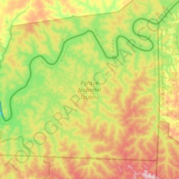
Name: Nationalpark Iguazú topographic map, elevation, terrain.
Average elevation: 837 ft
Minimum elevation: 341 ft
Maximum elevation: 1,503 ft
Other topographic maps
Click on a map to view its topography, its elevation and its terrain.
Cristo Rey
Argentinien > Mnes. > Posadas
Luz y Fuerza, Cristo Rey, Posadas, Municipio de Posadas, Departamento Capital, Mnes., Argentinien
Average elevation: 407 ft