Geolocate

Fulford topographic map

Click on the map to display elevation.

About this map

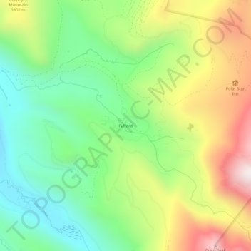
Name: Fulford topographic map, elevation, terrain.

Location: Fulford, Eagle County, Colorado, United States (39.49499 -106.67642 39.53499 -106.63642)

Average elevation: 10,213 ft

Minimum elevation: 8,963 ft

Maximum elevation: 12,113 ft

Eagle County trails, hiking, mountain biking, running and outdoor activities

Gear up for your next adventure:

🔥Plasma Lighters - Windproof lighters that work in any weather condition
🔌Solar Panel Charger - Charge gear sustainably outdoors
🔦LED Headlamp - Bright and durable LED headlamp for night navigation
🏕️Family Camping Gear - Essentials for group camping trips
🪶Wildlife Field Guides - Learn animal tracking and species ID

As an Amazon Associate, this site earns from qualifying purchases at no extra cost to you.