Golpayegan topographic map
Interactive map
Click on the map to display elevation.
About this map
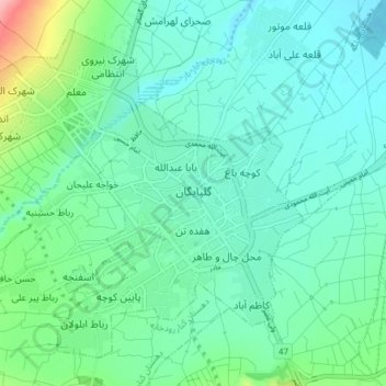
Name: Golpayegan topographic map, elevation, terrain.
Average elevation: 5,981 ft
Minimum elevation: 5,886 ft
Maximum elevation: 6,355 ft

Click on the map to display elevation.
Name: Golpayegan topographic map, elevation, terrain.
Average elevation: 5,981 ft
Minimum elevation: 5,886 ft
Maximum elevation: 6,355 ft