
Gunung Patuha topographic map
Interactive map
Click on the map to display elevation.
About this map
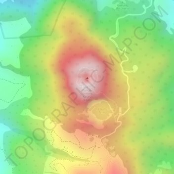
Name: Gunung Patuha topographic map, elevation, terrain.
Location: Gunung Patuha, Bandung, Java occidental, 40973, Indonésie (-7.16255 107.39995 -7.16245 107.40005)
Average elevation: 6,900 ft
Minimum elevation: 5,886 ft
Maximum elevation: 7,927 ft
Other topographic maps
Click on a map to view its topography, its elevation and its terrain.
Papandayan
Indonésie > Java occidental > Bandung
Papandayan, Bandung, Java occidental, Indonésie
Average elevation: 7,608 ft
Gunung Kendang
Indonésie > Java occidental > Bandung
Gunung Kendang, Bandung, Java occidental, Indonésie
Average elevation: 7,493 ft