
Sand Bay topographic map
Interactive map
Click on the map to display elevation.
About this map
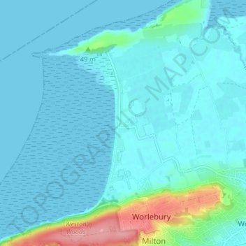
Name: Sand Bay topographic map, elevation, terrain.
Average elevation: 49 ft
Minimum elevation: 0 ft
Maximum elevation: 367 ft
Other topographic maps
Click on a map to view its topography, its elevation and its terrain.
Golling
Vereinigtes Königreich > England > North Somerset > Banwell
Golling, Banwell, North Somerset, England, BS29 6DG, Vereinigtes Königreich
Average elevation: 75 ft