
Bastam topographic map
Interactive map
Click on the map to display elevation.
About this map
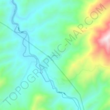
Name: Bastam topographic map, elevation, terrain.
Average elevation: 5,883 ft
Minimum elevation: 5,282 ft
Maximum elevation: 7,549 ft
Other topographic maps
Click on a map to view its topography, its elevation and its terrain.
Suteh
Iran > Kurdistan Province > Saqqez County > دهستان چهل چشمه غربی
Suteh, دهستان چهل چشمه غربی, بخش سرشیو, Saqqez County, Kurdistan Province, Iran
Average elevation: 5,837 ft