
Cathedral City topographic map
Click on the map to display elevation.
About this map
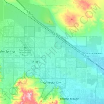
Name: Cathedral City topographic map, elevation, terrain.
Average elevation: 574 ft
Minimum elevation: 190 ft
Maximum elevation: 2,159 ft
Riverside County trails, hiking, mountain biking, running and outdoor activities
Other topographic maps
Click on a map to view its topography, its elevation and its terrain.
Agua Caliente Park
United States > California > Riverside County > Cathedral City
Average elevation: 397 ft