Geolocate

Bloomfield topographic map

Click on the map to display elevation.

About this map
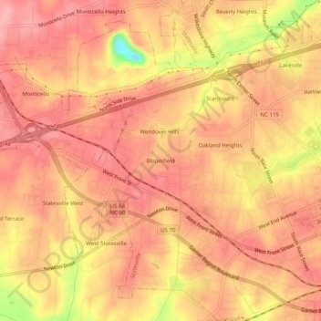
Name: Bloomfield topographic map, elevation, terrain.

Location: Bloomfield, Statesville, Iredell County, North Carolina, 28687, United States (35.77069 -80.93591 35.81069 -80.89591)

Average elevation: 915 ft

Minimum elevation: 646 ft

Maximum elevation: 1,007 ft

Iredell County trails, hiking, mountain biking, running and outdoor activities

Gear up for your next adventure:

🔥Camping Stove - Portable stove for camping and backcountry cooking
🔥Fast-Boil Camping Stoves - Efficient cooking systems for quick trail meals
⌚GPS Sports Watch - GPS watch for running, hiking and training
🎒Day Hiking Backpack - Lightweight backpack perfect for day trips and outdoor adventures
🌄Hiking Binoculars - Compact binoculars for scenic views and trail spotting

As an Amazon Associate, this site earns from qualifying purchases at no extra cost to you.