
Bohai Sea topographic map
Interactive map
Click on the map to display elevation.
About this map
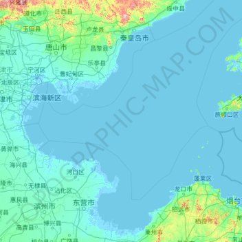
Name: Bohai Sea topographic map, elevation, terrain.
Location: Bohai Sea, Laoting, Tangshan City, Hebei, 265800, PRC (37.05261 117.56472 40.25707 121.92785)
Average elevation: 102 ft
Minimum elevation: -13 ft
Maximum elevation: 4,262 ft
Other topographic maps
Click on a map to view its topography, its elevation and its terrain.