
Schloss Beichlingen topographic map
Interactive map
Click on the map to display elevation.
About this map
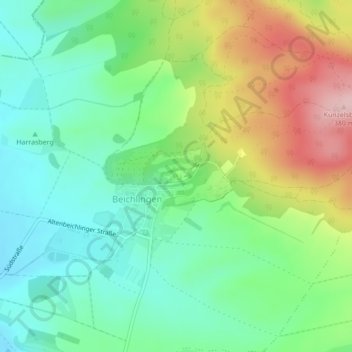
Name: Schloss Beichlingen topographic map, elevation, terrain.
Average elevation: 797 ft
Minimum elevation: 558 ft
Maximum elevation: 1,247 ft
Other topographic maps
Click on a map to view its topography, its elevation and its terrain.
Burgwenden
Deutschland > Thüringen > Landkreis Sömmerda > Kölleda
Burgwenden, Kölleda, Landkreis Sömmerda, Thüringen, Deutschland
Average elevation: 866 ft
Großmonra
Deutschland > Thüringen > Landkreis Sömmerda > Kölleda
Großmonra, Kölleda, Landkreis Sömmerda, Thüringen, Deutschland
Average elevation: 787 ft