Geolocate

Rust topographic map

Click on the map to display elevation.

About this map

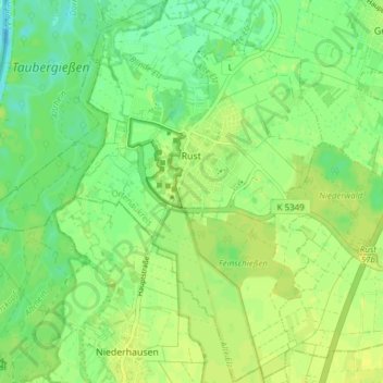
Name: Rust topographic map, elevation, terrain.

Location: Rust, Verwaltungsgemeinschaft Ettenheim, Ortenaukreis, Baden-Württemberg, 77977, Germany (48.23584 7.68234 48.28659 7.75257)

Average elevation: 541 ft

Minimum elevation: 509 ft

Maximum elevation: 564 ft

Other topographic maps

Click on a map to view its topography, its elevation and its terrain.

Unterstmatt

Germany > Baden-Württemberg > Ortenaukreis > Sasbach > Sasbach

Average elevation: 2,861 ft

Gear up for your next adventure:

🧦Hiking Socks - Comfortable socks to prevent blisters on long hikes
🛠️Backpacking Tool Kit - Essential toolkit for outdoor repairs
🧯Emergency Survival Kit - All‑in‑one survival essentials for the backcountry
🔥Plasma Lighters - Windproof lighters that work in any weather condition
🩹Survival Bandages - High‑quality bandages for emergencies

As an Amazon Associate, this site earns from qualifying purchases at no extra cost to you.