
Blickweiler topographic map
Interactive map
Click on the map to display elevation.
About this map
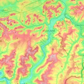
Name: Blickweiler topographic map, elevation, terrain.
Average elevation: 965 ft
Minimum elevation: 646 ft
Maximum elevation: 1,339 ft
Other topographic maps
Click on a map to view its topography, its elevation and its terrain.
Lautzkirchen
Deutschland > Saarland > Blieskastel > Lautzkirchen
Lautzkirchen, Blieskastel, Saarpfalz-Kreis, Saarland, 66440, Deutschland
Average elevation: 869 ft
Riesweiler
Deutschland > Saarland > Blieskastel > Riesweiler
Riesweiler, Blieskastel, Saarpfalz-Kreis, Saarland, Deutschland
Average elevation: 1,004 ft