
Rhynd topographic map
Interactive map
Click on the map to display elevation.
About this map
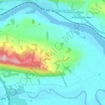
Name: Rhynd topographic map, elevation, terrain.
Average elevation: 131 ft
Minimum elevation: -7 ft
Maximum elevation: 719 ft
Other topographic maps
Click on a map to view its topography, its elevation and its terrain.
Elcho Castle
United Kingdom > Scotland > Perth and Kinross > Perth > Rhynd
Elcho Castle, Rhynd, Perth, Perth and Kinross, Scotland, PH2 8QQ, United Kingdom
Average elevation: 125 ft
Kinfauns
United Kingdom > Scotland > Perth and Kinross > Perth
Kinfauns, Perth, Perth and Kinross, Scotland, PH2 7LD, United Kingdom
Average elevation: 272 ft
Dupplin Loch
United Kingdom > Scotland > Perth and Kinross > Perth
Dupplin Loch, Perth, Perth and Kinross, Scotland, United Kingdom
Average elevation: 427 ft