
Tenango topographic map
Interactive map
Click on the map to display elevation.
About this map
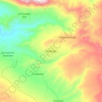
Name: Tenango topographic map, elevation, terrain.
Location: Tenango, Ocosingo, Chiapas, México (16.86455 -92.30317 16.94455 -92.22317)
Average elevation: 4,190 ft
Minimum elevation: 2,730 ft
Maximum elevation: 5,997 ft