
Selenter See topographic map
Interactive map
Click on the map to display elevation.
About this map
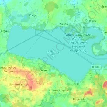
Name: Selenter See topographic map, elevation, terrain.
Average elevation: 151 ft
Minimum elevation: 102 ft
Maximum elevation: 302 ft
Other topographic maps
Click on a map to view its topography, its elevation and its terrain.
24238
Deutschland > Schleswig-Holstein > Plön > Lammershagen
24238, Lammershagen, Selent/Schlesen, Plön, Schleswig-Holstein, Deutschland
Average elevation: 177 ft