
Leominster State Forest topographic map
Interactive map
Click on the map to display elevation.
About this map
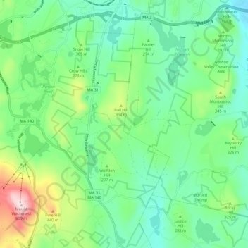
Name: Leominster State Forest topographic map, elevation, terrain.
Average elevation: 899 ft
Minimum elevation: 486 ft
Maximum elevation: 1,991 ft
Other topographic maps
Click on a map to view its topography, its elevation and its terrain.
Fall Brook
USA > Massachusetts > Leominster
Fall Brook, Leominster, Worcester, Massachusetts, 01453-3312, USA
Average elevation: 358 ft