
San Vicente de Chucurí topographic map
Interactive map
Click on the map to display elevation.
About this map
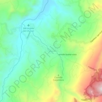
Name: San Vicente de Chucurí topographic map, elevation, terrain.
Location: San Vicente de Chucurí, Santander, Colombia (6.83873 -73.45168 6.91873 -73.37168)
Average elevation: 2,782 ft
Minimum elevation: 1,155 ft
Maximum elevation: 6,709 ft