
Lügde topographic map
Interactive map
Click on the map to display elevation.
About this map
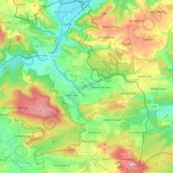
Name: Lügde topographic map, elevation, terrain.
Location: Lügde, Kreis Lippe, North Rhine-Westphalia, 32676, Germany (51.84963 9.18605 51.97769 9.34621)
Average elevation: 794 ft
Minimum elevation: 299 ft
Maximum elevation: 1,634 ft