
Morshausen topographic map
Interactive map
Click on the map to display elevation.
About this map
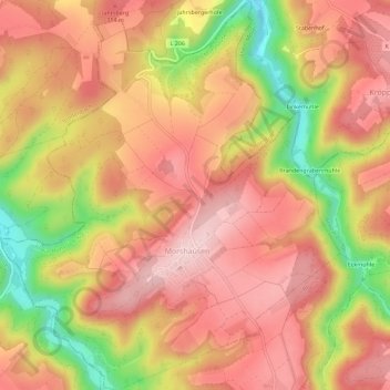
Name: Morshausen topographic map, elevation, terrain.
Average elevation: 810 ft
Minimum elevation: 308 ft
Maximum elevation: 1,099 ft
Other topographic maps
Click on a map to view its topography, its elevation and its terrain.
Geierlay
Deutschland > Rheinland-Pfalz > Rhein-Hunsrück-Kreis > Mörsdorf
Geierlay, Mörsdorf, Kastellaun, Rhein-Hunsrück-Kreis, Rheinland-Pfalz, 56290, Deutschland
Average elevation: 1,047 ft
Bergenhausen
Deutschland > Rheinland-Pfalz > Rhein-Hunsrück-Kreis > Bergenhausen
Bergenhausen, Simmern-Rheinböllen, Rhein-Hunsrück-Kreis, Rheinland-Pfalz, Deutschland
Average elevation: 1,322 ft