
West Chesterfield topographic map
Interactive map
Click on the map to display elevation.
About this map
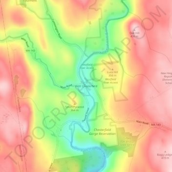
Name: West Chesterfield topographic map, elevation, terrain.
Location: West Chesterfield, Hampshire, Massachusetts, 01084, USA (42.38286 -72.89593 42.42286 -72.85593)
Average elevation: 1,109 ft
Minimum elevation: 656 ft
Maximum elevation: 1,424 ft