
My topographic map
Interactive map
Click on the map to display elevation.
About this map
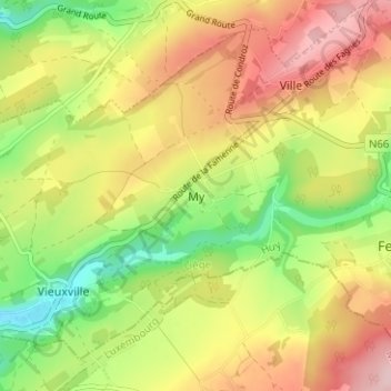
Name: My topographic map, elevation, terrain.
Location: My, Ferrières, Huy, Liège, Wallonia, 4190, Belgium (50.38526 5.55260 50.42526 5.59260)
Average elevation: 801 ft
Minimum elevation: 449 ft
Maximum elevation: 1,155 ft
Other topographic maps
Click on a map to view its topography, its elevation and its terrain.
Bassin de décantation des résidus miniers
Belgium > Liège > Huy > Wanze > Huccorgne > Le Taillis
Average elevation: 436 ft