
El Portillo topographic map
Interactive map
Click on the map to display elevation.
About this map
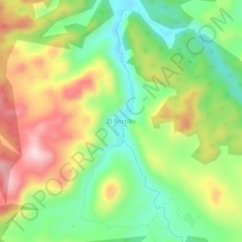
Name: El Portillo topographic map, elevation, terrain.
Location: El Portillo, Villaflores, Chiapas, México (16.43951 -93.28050 16.47951 -93.24050)
Average elevation: 3,740 ft
Minimum elevation: 3,278 ft
Maximum elevation: 4,354 ft