
Gippe topographic map
Interactive map
Click on the map to display elevation.
About this map
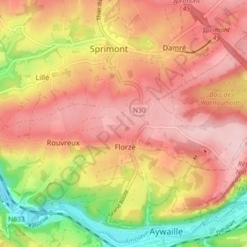
Name: Gippe topographic map, elevation, terrain.
Location: Gippe, Rouvreux, Sprimont, Liège, Wallonie, 4140, Belgique (50.47340 5.64537 50.51340 5.68537)
Average elevation: 768 ft
Minimum elevation: 354 ft
Maximum elevation: 1,037 ft
Other topographic maps
Click on a map to view its topography, its elevation and its terrain.