Geolocate

Bostwick topographic map

Click on the map to display elevation.

About this map
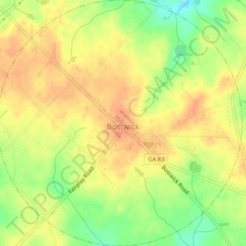
Name: Bostwick topographic map, elevation, terrain.

Location: Bostwick, Morgan County, Georgia, United States (33.72329 -83.53232 33.75231 -83.49759)

Average elevation: 725 ft

Minimum elevation: 640 ft

Maximum elevation: 768 ft

Morgan County trails, hiking, mountain biking, running and outdoor activities

Other topographic maps

Click on a map to view its topography, its elevation and its terrain.

Fairplay

United States > Georgia > Morgan County

Average elevation: 732 ft

Gear up for your next adventure:

🥾Hiking Shoes - Durable and comfortable shoes for trail hiking
⌚Solar GPS Watches - Advanced multisport watches with built-in topographic maps
🥾Women's Hiking Boots - Top-rated trail boots with ankle support and superior grip
🧢Outdoor Hiking Hat - Sun protection hat for outdoor explorers
🏫Relief Map Kits - Hands-on tools for teaching landforms and elevation

As an Amazon Associate, this site earns from qualifying purchases at no extra cost to you.