
Javierre topographic map
Interactive map
Click on the map to display elevation.
About this map
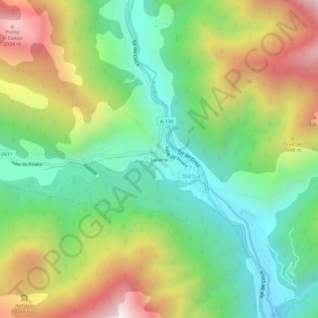
Name: Javierre topographic map, elevation, terrain.
Location: Javierre, Bielsa, Sobrarbe, Huesca, Aragón, 22365, Spanje (42.61563 0.19342 42.65563 0.23342)
Average elevation: 4,593 ft
Minimum elevation: 3,117 ft
Maximum elevation: 6,936 ft