
Blumenrod topographic map
Interactive map
Click on the map to display elevation.
About this map
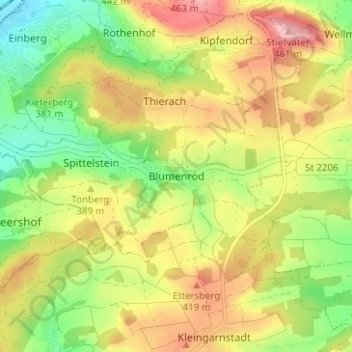
Name: Blumenrod topographic map, elevation, terrain.
Location: Blumenrod, Coburg, Upper Franconia, Bavaria, 96472, Germany (50.25240 11.05664 50.29240 11.09664)
Average elevation: 1,250 ft
Minimum elevation: 1,020 ft
Maximum elevation: 1,493 ft