
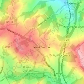
West Bretton topographic map
Interactive map
Click on the map to display elevation.
About this map
Name: West Bretton topographic map, elevation, terrain.
Average elevation: 361 ft
Minimum elevation: 131 ft
Maximum elevation: 538 ft
Other topographic maps
Click on a map to view its topography, its elevation and its terrain.
Midgley
United Kingdom > England > Wakefield
Midgley, Sitlington, Wakefield, West Yorkshire, England, WF4 4JJ, United Kingdom
Average elevation: 404 ft
Durkar
United Kingdom > England > Wakefield
Durkar, Wakefield, West Yorkshire, England, WF4 3AY, United Kingdom
Average elevation: 144 ft
Normanton
United Kingdom > England > Wakefield > Altofts
Normanton, Altofts, Wakefield, West Yorkshire, England, United Kingdom
Average elevation: 108 ft
Crofton
United Kingdom > England > Wakefield > Crofton
Crofton, Wakefield, West Yorkshire, England, United Kingdom
Average elevation: 177 ft