
Thank you for supporting this site ❤️
Make a donation
Make a donation
Gear up for your next adventure:
As an Amazon Associate, this site earns from qualifying purchases at no extra cost to you.
Bougtob topographic map
Click on the map to display elevation.
Thank you for supporting this site ❤️
Make a donation
Make a donation
Gear up for your next adventure:
As an Amazon Associate, this site earns from qualifying purchases at no extra cost to you.
About this map
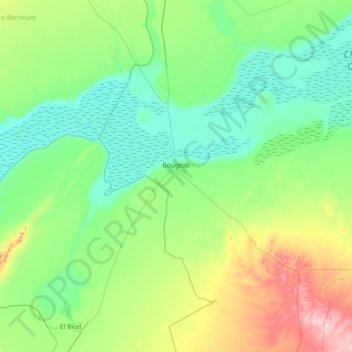
Name: Bougtob topographic map, elevation, terrain.
Location: Bougtob, Bougtob District, El Bayadh, 32010, Algeria (33.71996 0.02196 34.32113 0.59337)
Average elevation: 3,451 ft
Minimum elevation: 3,199 ft
Maximum elevation: 4,341 ft
Thank you for supporting this site ❤️
Make a donation
Make a donation
Gear up for your next adventure:
As an Amazon Associate, this site earns from qualifying purchases at no extra cost to you.