
Linnburn topographic map
Interactive map
Click on the map to display elevation.
About this map
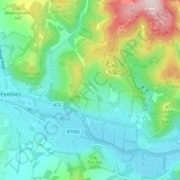
Name: Linnburn topographic map, elevation, terrain.
Location: Linnburn, Scottish Borders, Scotland, EH45 8LZ, United Kingdom (55.63264 -3.17715 55.67264 -3.13715)
Average elevation: 823 ft
Minimum elevation: 482 ft
Maximum elevation: 1,788 ft