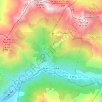
Villar-Loubière topographic map
Interactive map
Click on the map to display elevation.
About this map
Name: Villar-Loubière topographic map, elevation, terrain.
Average elevation: 6,178 ft
Minimum elevation: 3,117 ft
Maximum elevation: 10,016 ft

Click on the map to display elevation.
Name: Villar-Loubière topographic map, elevation, terrain.
Average elevation: 6,178 ft
Minimum elevation: 3,117 ft
Maximum elevation: 10,016 ft