
Nagtabon Beach topographic map
Interactive map
Click on the map to display elevation.
About this map
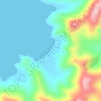
Name: Nagtabon Beach topographic map, elevation, terrain.
Average elevation: 220 ft
Minimum elevation: 0 ft
Maximum elevation: 801 ft
Other topographic maps
Click on a map to view its topography, its elevation and its terrain.
Bacungan
Philippines > Mimaropa > Bacungan
Bacungan, Puerto Princesa, Mimaropa, Philippines
Average elevation: 269 ft