
Roys Lagoon topographic map
Interactive map
Click on the map to display elevation.
About this map
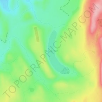
Name: Roys Lagoon topographic map, elevation, terrain.
Average elevation: 2,628 ft
Minimum elevation: 2,408 ft
Maximum elevation: 2,949 ft
Other topographic maps
Click on a map to view its topography, its elevation and its terrain.
Lake Tekapo
New Zealand > Canterbury > Lake Tekapo
Lake Tekapo, Mackenzie District, Canterbury, New Zealand
Average elevation: 2,441 ft
Phantom Lagoon
New Zealand > Canterbury > Lake Tekapo
Phantom Lagoon, Lilybank Road, Lake Tekapo, Mackenzie District, Canterbury, New Zealand
Average elevation: 3,789 ft
Trig 'N' Tarn
New Zealand > Canterbury > Lake Tekapo
Trig 'N' Tarn, Godley Peaks Road, Lake Tekapo, Mackenzie District, Canterbury, New Zealand
Average elevation: 2,484 ft