
Lac Stuart topographic map
Interactive map
Click on the map to display elevation.
About this map
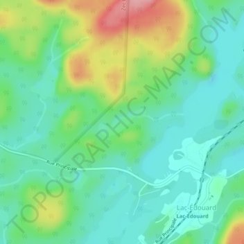
Name: Lac Stuart topographic map, elevation, terrain.
Average elevation: 1,276 ft
Minimum elevation: 1,148 ft
Maximum elevation: 1,558 ft
Other topographic maps
Click on a map to view its topography, its elevation and its terrain.
Lac Pointu
Canada > Québec > Lac-Édouard
Lac Pointu, Rue Principale, Lac-Édouard, La Tuque (agglomération), Mauricie, Québec, Canada
Average elevation: 1,578 ft