
Reinhardsbrunn topographic map
Interactive map
Click on the map to display elevation.
About this map
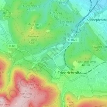
Name: Reinhardsbrunn topographic map, elevation, terrain.
Location: Reinhardsbrunn, Landkreis Gotha, Thüringen, 99894, Deutschland (50.84838 10.53443 50.88838 10.57443)
Average elevation: 1,512 ft
Minimum elevation: 1,099 ft
Maximum elevation: 2,313 ft