
Isla Conejera topographic map
Interactive map
Click on the map to display elevation.
About this map
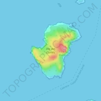
Name: Isla Conejera topographic map, elevation, terrain.
Location: Isla Conejera, Palma, Islas Baleares, España (mare territorial) (39.17518 2.95537 39.19054 2.97305)
Average elevation: 23 ft
Minimum elevation: 0 ft
Maximum elevation: 374 ft
Other topographic maps
Click on a map to view its topography, its elevation and its terrain.
Cap Vermell
España (mare territorial) > Islas Baleares > Palma
Cap Vermell, Palma, Islas Baleares, España (mare territorial)
Average elevation: 59 ft