
Modderfontein topographic map
Interactive map
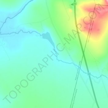
Click on the map to display elevation.
About this map
Name: Modderfontein topographic map, elevation, terrain.
Average elevation: 5,033 ft
Minimum elevation: 4,885 ft
Maximum elevation: 5,453 ft
Other topographic maps
Click on a map to view its topography, its elevation and its terrain.
Vaal Marina Community Center
South Africa > Gauteng > Sedibeng District Municipality > Midvaal Local Municipality
Vaal Marina Community Center, Midvaal Local Municipality, Sedibeng District Municipality, Gauteng, South Africa
Average elevation: 5,007 ft