
Rochehaut topographic map
Interactive map
Click on the map to display elevation.
About this map
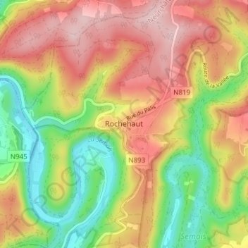
Name: Rochehaut topographic map, elevation, terrain.
Location: Rochehaut, Neufchâteau, Luxembourg, Wallonie, Belgique (49.82045 4.98701 49.86045 5.02701)
Average elevation: 1,017 ft
Minimum elevation: 604 ft
Maximum elevation: 1,414 ft