
Thank you for supporting this site ❤️
Make a donation
Make a donation
Gear up for your next adventure:
As an Amazon Associate, this site earns from qualifying purchases at no extra cost to you.
Zuleta topographic map
Click on the map to display elevation.
Thank you for supporting this site ❤️
Make a donation
Make a donation
Gear up for your next adventure:
As an Amazon Associate, this site earns from qualifying purchases at no extra cost to you.
About this map
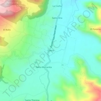
Name: Zuleta topographic map, elevation, terrain.
Location: Zuleta, Angochagua, Ibarra, Imbabura, 100114, Ecuador (0.18735 -78.11151 0.22735 -78.07151)
Average elevation: 9,767 ft
Minimum elevation: 9,229 ft
Maximum elevation: 11,207 ft
Thank you for supporting this site ❤️
Make a donation
Make a donation
Gear up for your next adventure:
As an Amazon Associate, this site earns from qualifying purchases at no extra cost to you.